
Winter weather is never uniform. Some regions may experience only mild snowfall while others are suddenly buried beneath several feet of snow in just a few hours. Among the most dramatic and localized winter events is what meteorologists call lake effect snow. This phenomenon has been known to paralyze cities, close highways, disrupt air travel, and even cut communities off from the outside world. The National Weather Service (NWS) issues a Lake Effect Snow Warning when conditions are favorable for heavy snowfall resulting from cold air moving over relatively warmer lake waters.
Understanding this weather event is crucial not only for meteorologists but also for residents, local governments, emergency services, and travelers. This article explores the science behind lake effect snow, the criteria for issuing warnings, historical examples, regional impacts, preparedness strategies, and the role of modern forecasting technology. By the end, you’ll gain a deep appreciation for the power of nature and the importance of safety measures during such events.
What is Lake Effect Snow?
Lake Effect Snow Warning occurs when a mass of cold, dry air moves across a warmer, unfrozen lake surface. The lake’s water evaporates into the air, adding heat and moisture. As this newly warmed, moist air rises, it condenses into clouds and produces snow when it reaches freezing layers in the atmosphere.
Unlike widespread snowstorms that cover large areas, lake effect snow is highly localized. Narrow bands of intense snow can form and drop several feet of snow over small regions, while areas just a few miles away might see only light flurries or even clear skies. This sharp contrast makes forecasting and warning issuance both challenging and essential.
Meteorological Conditions for Lake Effect Snow
Lake effect snow is not random. Certain meteorological ingredients must align perfectly:
| Condition | Role in Lake Effect Snow Formation |
|---|---|
| Cold Air Mass | Provides the temperature difference needed to drive evaporation and condensation. |
| Unfrozen Lake Surface | Warmer than the overlying air, supplies heat and moisture. |
| Wind Direction | Controls where the snow bands form and where they will deposit snow. |
| Fetch (distance air travels over water) | Longer fetch means more evaporation and moisture available. |
| Topography | Hills and elevated terrain enhance uplift, increasing snow accumulation. |
Typically, the temperature difference between the lake water surface and the air just above must be at least 13°C (23°F) for lake effect snow to develop.
Regions Most Affected by Lake Effect Snow
Lake Effect Snow Warning is most common in the Great Lakes region of North America, but it can occur anywhere cold air passes over a relatively warm, large body of water.
- United States: Areas downwind of the Great Lakes (Buffalo, Cleveland, Erie, Syracuse, and Michigan’s Upper Peninsula) experience the most significant impacts.
- Canada: Ontario receives heavy snow from Lakes Erie and Ontario, especially in the snowbelt regions.
- Other Global Examples: Similar phenomena occur in Japan (Sea of Japan), northern Europe (Baltic Sea), and Russia (Lake Baikal).
These regions are sometimes referred to as “snowbelts” due to their recurring exposure to this weather pattern.
Lake Effect Snow Warning: Definition and Criteria
A Lake Effect Snow Warning is issued by meteorological authorities when heavy snow, primarily produced by lake effect processes, is expected to cause significant travel disruptions and pose risks to life and property.
Key Criteria Used by the NWS:
- Snowfall rates expected to exceed 2 inches per hour.
- Total accumulations likely to surpass 6–8 inches in 12 hours or 8–12 inches in 24 hours, depending on the region.
- Accompanied by strong winds that reduce visibility to dangerous levels (whiteout conditions).
Warnings are often preceded by a Lake Effect Snow Watch (potential) or Advisory (less severe but impactful).
Characteristics of Lake Effect Snow Events
Lake Effect Snow Warning differs significantly from general winter storms:
- Narrow Snow Bands – These may be only a few miles wide but deliver intense snowfall.
- High Variability – One neighborhood may be buried under feet of snow, while a nearby area sees almost none.
- Short Duration, High Impact – A few hours of snowfall can equal the amount from a full-day winter storm.
- Wind-Driven Distribution – Even small shifts in wind direction can relocate snow bands entirely.
Historical Lake Effect Snow Events
Several notable events illustrate the destructive potential of lake effect snow:
- Buffalo, New York (November 2014): A historic storm dropped over 7 feet of snow in less than three days, collapsing roofs and stranding vehicles.
- Syracuse, New York (1993): A prolonged event delivered more than 40 inches in under 48 hours.
- Japan’s Sea of Japan Coast: Cities such as Niigata have recorded record-breaking snowfalls due to similar sea-effect processes.
These events highlight why accurate warnings are critical for saving lives and protecting infrastructure.
Impacts of Lake Effect Snow Warnings
Transportation
Lake Effect Snow Warning can shut down highways, airports, and rail lines. Poor visibility and slick surfaces often lead to multi-vehicle accidents.
Infrastructure
Heavy snow loads collapse roofs, damage power lines, and disrupt communication networks.
Public Safety
Whiteout conditions make emergency response difficult, sometimes isolating entire communities. Hypothermia and frostbite risks rise sharply for stranded individuals.
Economy
Business operations, supply chains, and local commerce suffer, sometimes taking weeks to recover.
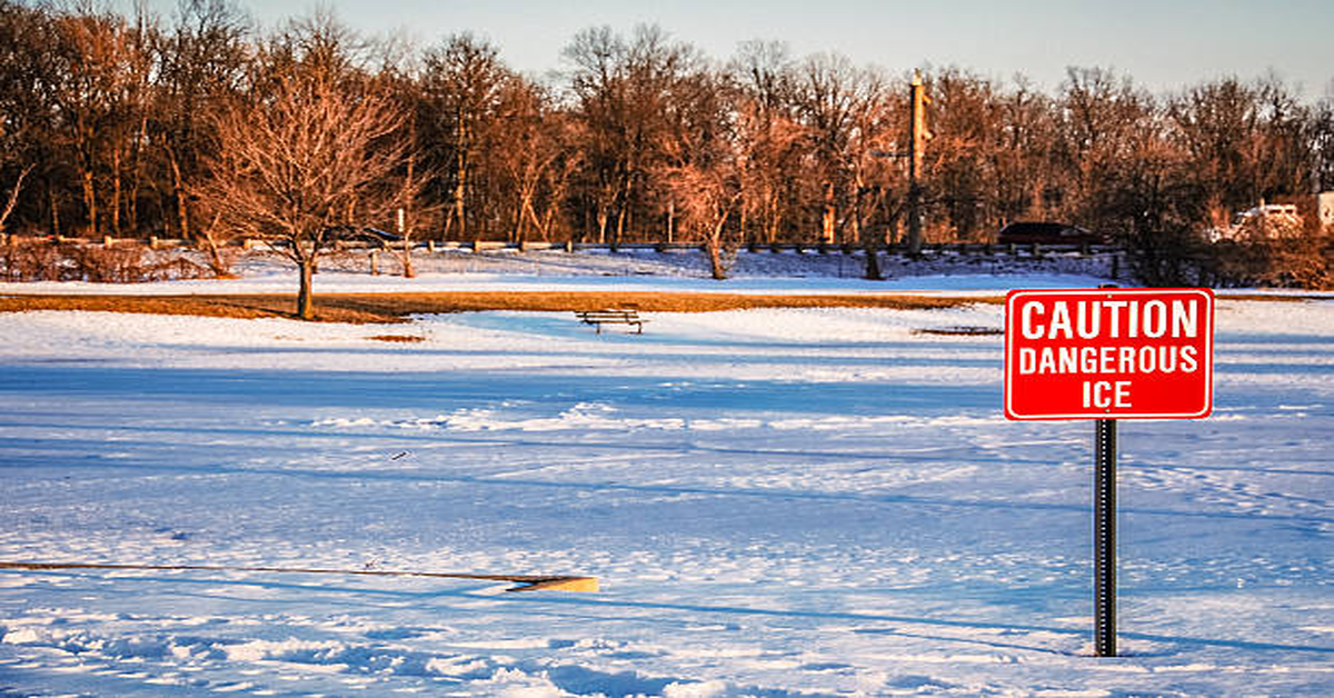
Preparedness and Safety Tips During a Lake Effect Snow Warning
When a Lake Effect Snow Warning is issued, it’s crucial to act immediately.
- Stay Indoors – Limit travel to emergencies only.
- Emergency Kit – Stock food, water, blankets, medications, flashlights, and batteries.
- Vehicle Preparedness – Keep a full gas tank, blankets, food, and a shovel in your car.
- Monitor Alerts – Use NOAA Weather Radio, apps, or local news updates.
- Check Roofs – Safely remove snow buildup to avoid collapse.
Forecasting Improvements and Challenges
Modern forecasting uses radar, satellite imagery, and high-resolution weather models to track snow band development. Still, challenges remain because of the narrow and fast-changing nature of snow bands.
- Advancements: Doppler radar now allows meteorologists to pinpoint snow intensity and location with high accuracy.
- Challenges: Predicting exact snowfall totals for specific neighborhoods remains difficult due to rapid band shifts.
Table: Comparison of Winter Weather Alerts
| Alert Type | Severity | Issued When | Public Action |
|---|---|---|---|
| Advisory | Moderate | Snow may impact travel but less severe. | Use caution on roads. |
| Watch | Potential | Conditions are favorable for heavy snow. | Stay alert, prepare supplies. |
| Warning | Severe | Heavy lake effect snow is imminent or occurring. | Avoid travel, follow safety steps. |
Conclusion
A Lake Effect Snow Warning is more than just a weather bulletin; it’s a life-saving message that communities must heed. The combination of sudden onset, intense snowfall, and localized impacts makes it one of the most dangerous winter weather events. By understanding the meteorological science, staying alert to warnings, and taking safety precautions, individuals and communities can reduce the risks associated with these storms.
Lake effect snow is a reminder of nature’s immense power and the need for respect, resilience, and readiness in the face of extreme weather.
FAQs
Q1. What is the main cause of lake effect snow?
Lake effect snow is caused by cold air passing over warmer, unfrozen lakes, which adds heat and moisture to the air, forming snow clouds.
Q2. How long does a lake effect snow event usually last?
Events can last anywhere from a few hours to several days, depending on wind patterns and atmospheric conditions.
Q3. Why are Lake Effect Snow Warnings important?
They alert communities to imminent heavy snowfall, enabling people to take precautions, avoid unnecessary travel, and protect property.
Q4. Can lake effect snow happen outside the Great Lakes region?
Yes. Any large water body combined with cold air can trigger it, such as the Sea of Japan or Baltic Sea regions.
Q5. How can I prepare for a Lake Effect Snow Warning?
Stay indoors, stock emergency supplies, prepare your vehicle for winter conditions, and follow updates from official weather services.